Wipe
Max Group
1
Modded
No
Player
0/120
Map
Procedural
Cycle
~ 23.8 Days
Vanilla
monthly
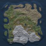

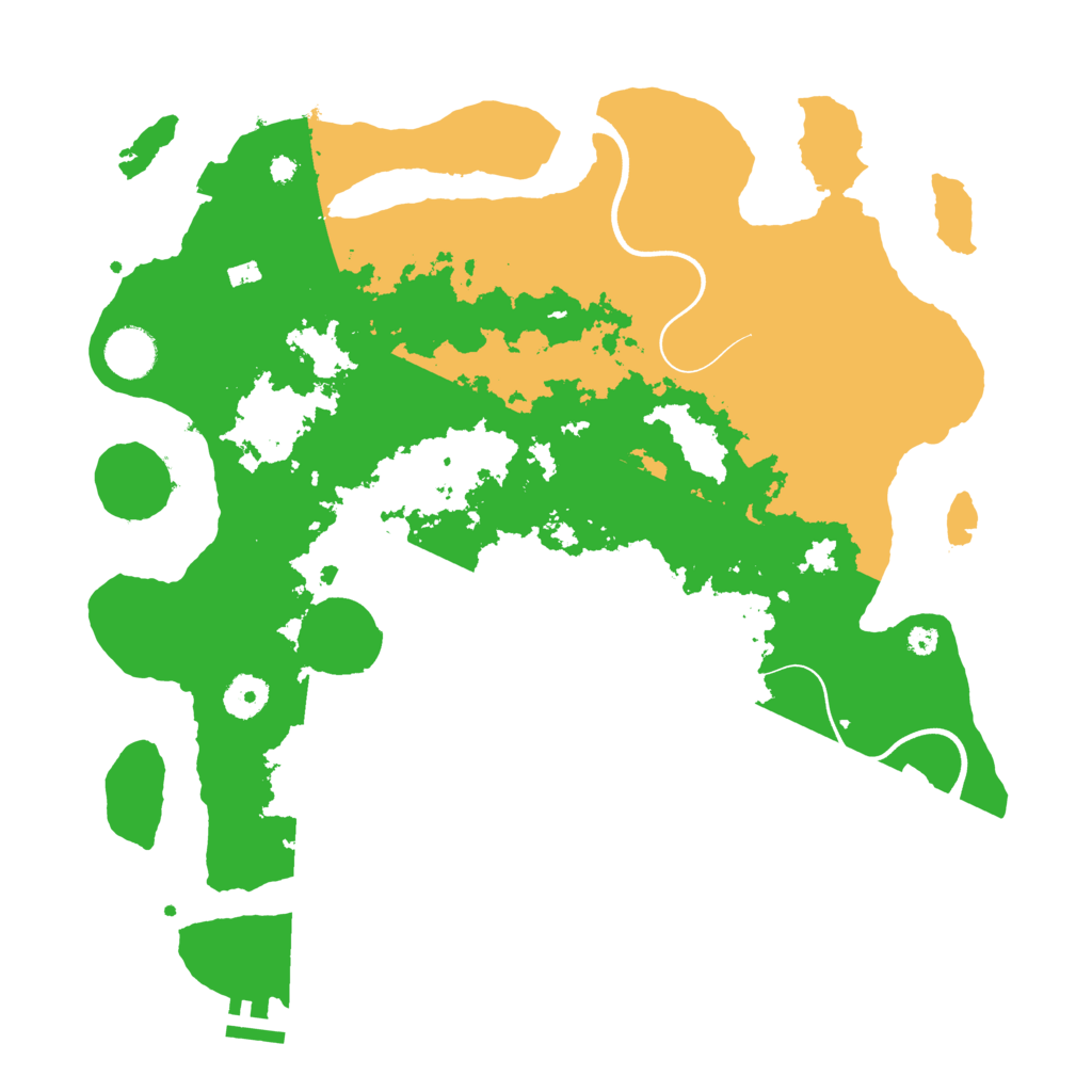

This Procedural Map is a dynamically generated map, with a size of 3,750 and the seed 554505502.
Having 2.04 sq. km, it is a pretty large island. It has a mixed scenery of biomes. There are 35.42% temperate biome, 23.40% arid biome and 41.18% arctic biome.
Almost all main monuments are present on this Rust island. Missing is the Oil Rig monument. The Launch Site is located in the south of the map. Across the island are 2 Warehouses, one Gas Station and 2 Supermarkets.
This map is currently running on one Rust server. In the past, this map was used for 14 wipes.
Download Image
Map Information |
|
|---|---|
| Map | Procedural Map |
| Size | 3,750 |
| Seed | 554505502 |
| Last generated | about 2 months ago |
| Main Biome | Arctic |
| Islands | 8 |
Monuments |
|
|
Airfield
|
|
|
Arctic Research Base
|
|
|
Bandit Town
|
|
|
Compound
|
|
|
Excavator
|
|
|
Harbor (2)
|
|
|
Junkyard
|
|
|
Launch Site
|
|
|
Military Tunnel
|
|
|
Nuclear Missile Silo
|
|
|
Oil Rig
|
|
|
Powerplant
|
|
|
Satellite Dish
|
|
|
Sphere Tank
|
|
|
Trainyard
|
|
|
Underwater Lab
|
|
|
Water Treatment Plant
|
|
Small Monuments |
|
|
Small Caves (4)
|
|
|
Medium Caves (2)
|
|
|
Large Caves (2)
|
|
|
Fishing Villages (3)
|
|
|
Gas Stations
|
|
|
Radtown Small
|
|
|
Stables
|
|
|
Supermarkets (2)
|
|
|
Lighthouses (2)
|
|
|
Quarries (3)
|
|
|
Swamps (3)
|
|
|
Warehouses (2)
|
|
|
Water Wells (2)
|
|
|
|
|
Stats |
|
| Island Size | 2.04 sq. km |
| Main Monuments | 17 |
| Temperate Biome | 35.42% |
| Arid Biome | 23.40% |
| Arctic Biome | 41.18% |
| Currently used by | 1 server |
| Ever used on | 14 servers |