
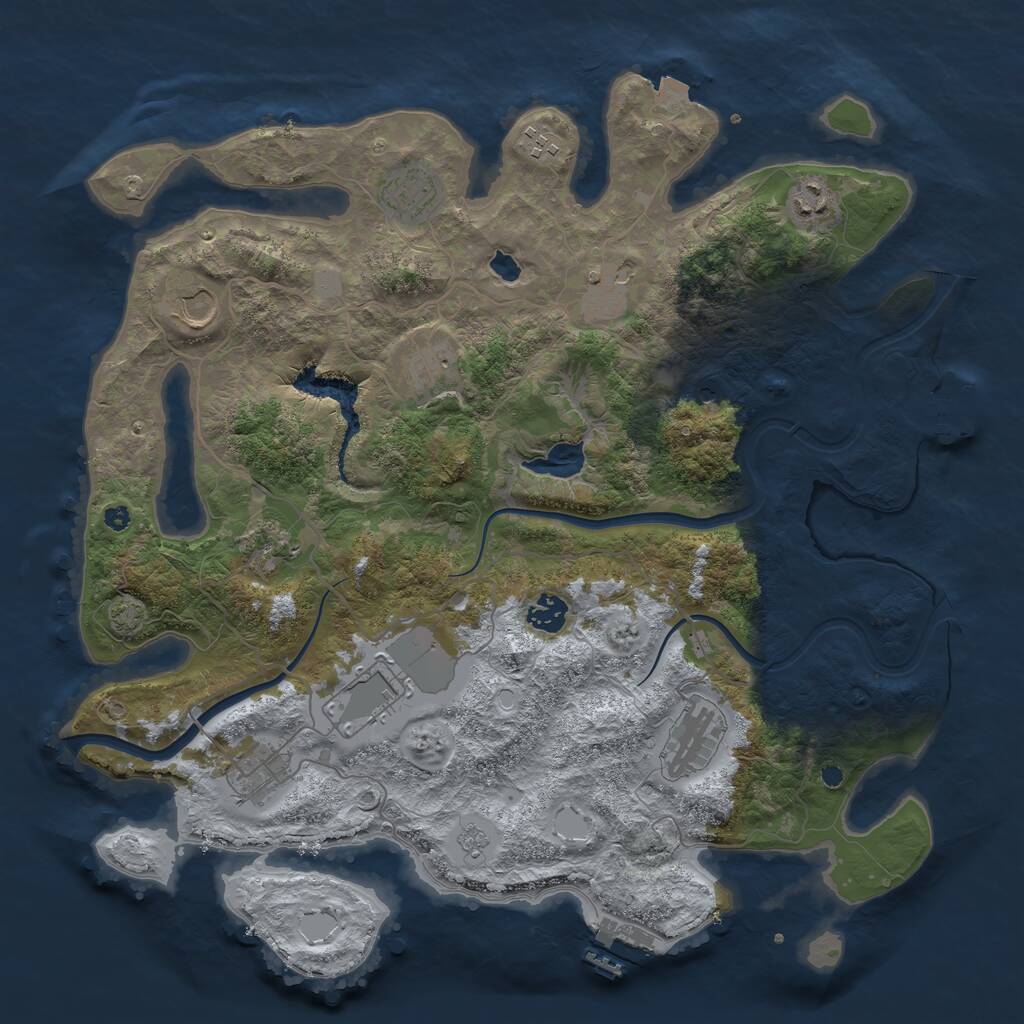

This Procedural Map is a dynamically generated map, with a size of 4,000 and the seed 1141138230.
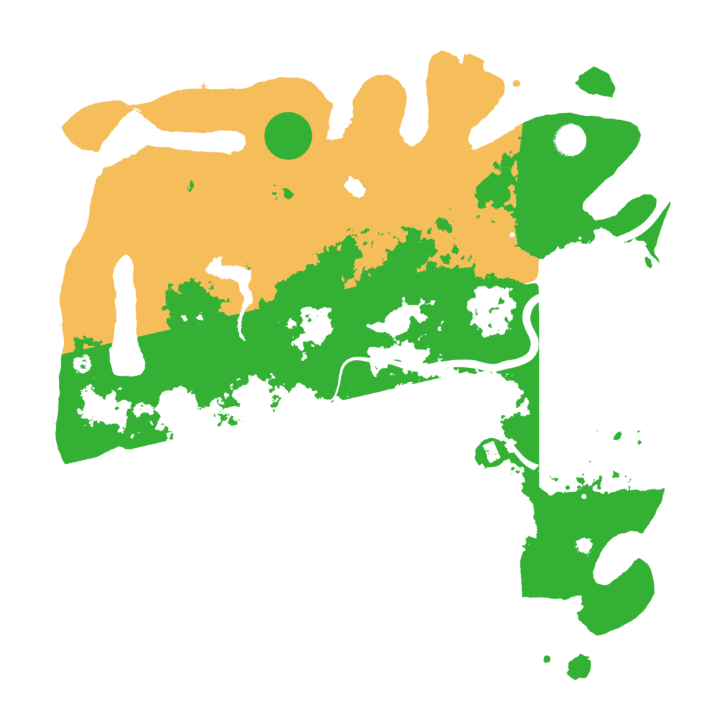
Having 2.21 sq. km, it is a pretty large island. It is dominated by the arctic biome. There are 27.66% temperate biome, 26.49% arid biome and 45.85% arctic biome.
Almost all main monuments are present on this Rust island. Missing is the Oil Rig monument. The Launch Site is located in the south of the map. Across the island are 2 Warehouses, 2 Gas Stations and 2 Supermarkets.
This map is currently running on 10 Rust servers. In the past, this map was used for 10 wipes.
Download Image
Map Information |
|
|---|---|
| Map | Procedural Map |
| Size | 4,000 |
| Seed | 1141138230 |
| Last generated | 18 days ago |
| Main Biome | Arctic |
| Islands | 5 |
Monuments |
|
|
Airfield
|
|
|
Arctic Research Base
|
|
|
Bandit Town
|
|
|
Compound
|
|
|
Excavator
|
|
|
Harbor (2)
|
|
|
Junkyard
|
|
|
Launch Site
|
|
|
Military Tunnel
|
|
|
Nuclear Missile Silo
|
|
|
Oil Rig
|
|
|
Powerplant
|
|
|
Satellite Dish
|
|
|
Sphere Tank
|
|
|
Trainyard
|
|
|
Underwater Lab
|
|
|
Water Treatment Plant
|
|
Small Monuments |
|
|
Small Caves (4)
|
|
|
Medium Caves (3)
|
|
|
Large Caves
|
|
|
Fishing Villages (3)
|
|
|
Gas Stations (2)
|
|
|
Radtown Small
|
|
|
Stables (2)
|
|
|
Supermarkets (2)
|
|
|
Lighthouses (2)
|
|
|
Quarries (3)
|
|
|
Swamps (2)
|
|
|
Warehouses (2)
|
|
|
Water Wells (6)
|
|
|
|
|
Stats |
|
| Island Size | 2.21 sq. km |
| Main Monuments | 17 |
| Temperate Biome | 27.66% |
| Arid Biome | 26.49% |
| Arctic Biome | 45.85% |
| Currently used by | 10 servers |
| Ever used on | 15 servers |