Procedural Map - Size: 3750 Seed: 1865224789
This map was generated with a previous Rust version and might be outdated by now.
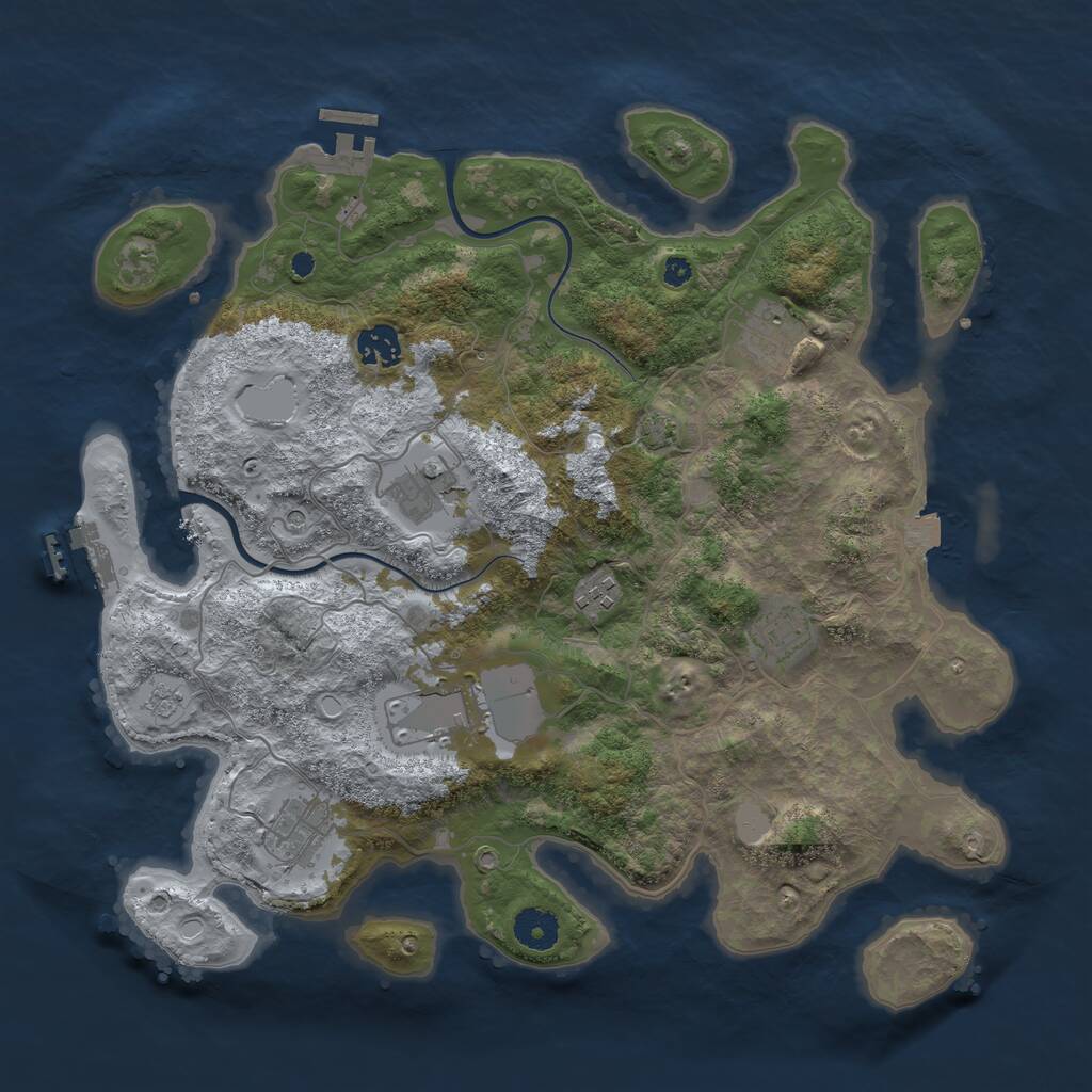

This Procedural Map is a dynamically generated map, with a size of 3,750 and the seed 1865224789.
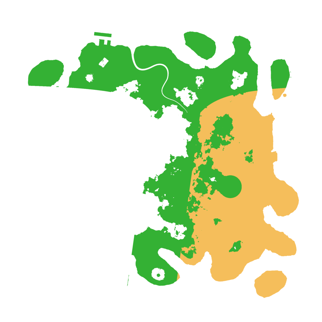
Having 1.85 sq. km, it is a medium sized island. It is dominated by the arctic biome. There are 32.25% temperate biome, 25.32% arid biome and 42.43% arctic biome.
A various number of main monuments is present on this Rust island. The Launch Site is located in the center of the map. Across the island are 2 Warehouses, 3 Gas Stations and 2 Supermarkets.
This map is currently not running on any Rust server. Only one time, this map was used before.
Download Image
Map Information |
|
|---|---|
| Map | Procedural Map |
| Size | 3,750 |
| Seed | 1865224789 |
| Last generated | over 1 year ago |
| Main Biome | Arctic |
| Islands | 8 |
Monuments |
|
|
Airfield
|
|
|
Arctic Research Base
|
|
|
Bandit Town
|
|
|
Compound
|
|
|
Excavator
|
|
|
Harbor (2)
|
|
|
Junkyard
|
|
|
Launch Site
|
|
|
Military Tunnel
|
|
|
Nuclear Missile Silo
|
|
|
Oil Rig
|
|
|
Powerplant
|
|
|
Satellite Dish
|
|
|
Sphere Tank
|
|
|
Trainyard
|
|
|
Underwater Lab
|
|
|
Water Treatment Plant
|
|
Small Monuments |
|
|
Small Caves (4)
|
|
|
Medium Caves (3)
|
|
|
Large Caves
|
|
|
Fishing Villages (3)
|
|
|
Gas Stations (3)
|
|
|
Radtown Small
|
|
|
Stables (2)
|
|
|
Supermarkets (2)
|
|
|
Lighthouses (2)
|
|
|
Quarries (3)
|
|
|
Swamps (3)
|
|
|
Warehouses (2)
|
|
|
Water Wells (2)
|
|
|
|
|
Stats |
|
| Island Size | 1.85 sq. km |
| Main Monuments | 13 |
| Temperate Biome | 32.25% |
| Arid Biome | 25.32% |
| Arctic Biome | 42.43% |
| Currently used by | 0 servers |
| Ever used on | 1 server |